For most of human history, the open ocean kept its secrets simply by being too big to watch. A vessel that wanted to disappear only had to sail far enough from shore. In 2026 that is no longer true — and the reason is a quiet convergence of satellites and machine learning that is making the sea, for the first time, legible at a global scale.
The problem these systems exist to solve is deceptively simple. Most large vessels broadcast their position over the Automatic Identification System (AIS). But a ship that intends to fish illegally can switch its transponder off and vanish from the maps the world relies on. In my own systematic review of at-sea transshipment, I found that only 50–70% of events are ever captured, precisely because of this deliberate “going dark.”
Why ships disappear
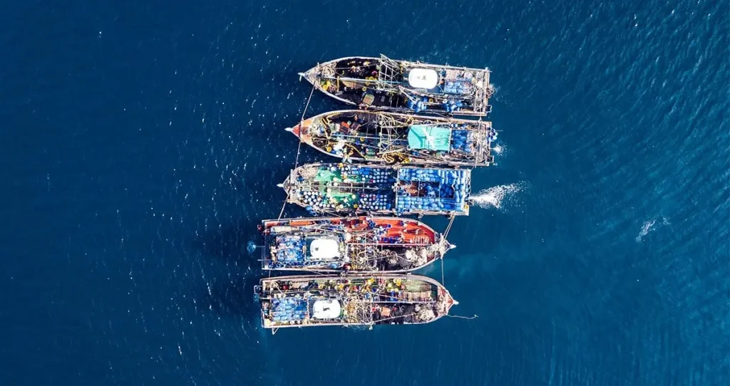
Going dark is not an accident; it is a method. Illegal, unreported and unregulated (IUU) fishing costs an estimated USD 10–23.5 billion a year, and the at-sea transfer of catch between vessels is its primary logistical channel. Turn off the transponder during the transfer, and the catch is effectively laundered into the legal supply chain.
They can switch off their transponders. They cannot switch off their lights.
What the satellites actually see
A vessel can hide its signal, but not its physical presence. That is the opening these systems exploit. Platforms like Skylight, built by the Allen Institute for AI, run open-source computer-vision models trained on public satellite data from NASA, the European Space Agency and the US Geological Survey. They look for the boats that appear in the imagery but not on AIS — the dark fleet.
- Nighttime light signatures reveal vessels fishing under cover of darkness.
- Radar (SAR) sees through cloud and night to spot hulls on open water.
- The models cross-check what is visible against who is broadcasting — and surface the gap.
What used to require fleets of patrol boats and rooms of analysts now runs as software. As one summary of the field put it, monitoring that once scaled with staffing now scales with compute — which is why coverage is suddenly affordable for the countries that need it most.
From detection to enforcement
Detection, though, is the easy part. The harder problem is what happens after a dark vessel is flagged: a sighting is not a seizure. In June 2026 The Nature Conservancy began deploying this approach in Indonesia’s Savu Sea, with the Philippines and Cambodia named as the next regions to come online. The technology has arrived; the institutions to act on it are still catching up.
This is the gap my work keeps returning to. We are very close to a world where nowhere at sea is truly unwatched. Whether that visibility becomes accountability depends less on better models and more on the governance we build around them.